Exhibits
Exhibits - Phase I
Pulaski County Land Use Plan Phase I: Adopted May 27, 2025
Thank you for visiting Phase I Exhibits, adopted May 27, 2025 by the Pulaski County Quorum Court.
Click on any image to look at the material in greater detail. The document will open up in a new web browser window for easier viewing.
The symbol 🔗 means the graphic serves as a hyperlink.
Plan Document
🔗
Appendix B: Future Land Use Categories & Descriptions
🔗
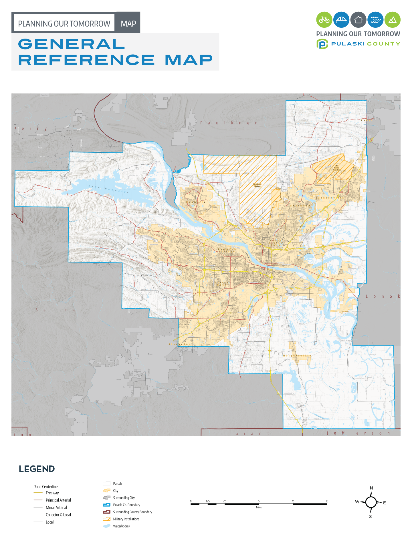
Overall County Map
Created for overall county reference, the draft Overall County Map is a comprehensive view of Pulaski County. As depicted in the legend, a variety of land use related data is displayed, including: municipal boundaries, road centerlines and trails data, individual parcel boundaries, as well as rivers, streams, and other water bodies.
🔗
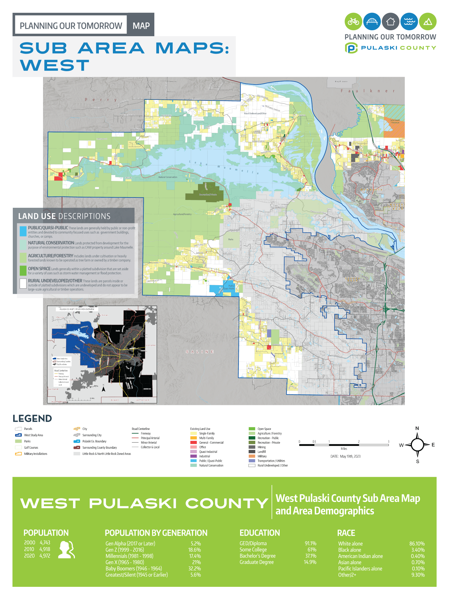
Sub-Area Maps
In order to provide a detailed view of all unincorporated areas of Pulaski County, a series of three sub-area maps are provided to help reference each area. For convenience, the sub-area maps are organized graphically as West, North, and Southeast.
West
🔗
North
🔗
Southeast
🔗
Demographic Data
Review information on Pulaski County and comparison areas. This information analyzes important demographics and community character information.
Population, Education, & Race
🔗
Transportation & Age

🔗
Housing
🔗